DR:FR Get Ready NSW Pilot Communities
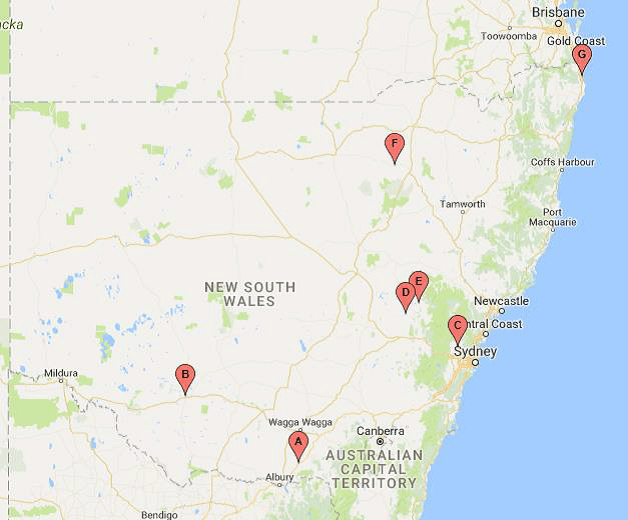
Thanks to support from our donor partners, including the NSW Government’s Get Ready NSW initiative, the project started in New South Wales. The first three pilot communities to participate in the program were Ocean Shores, Wee Waa and North Richmond.
FRRR worked with these communities to identify what projects needed to take place to help them withstand and recover from any future disaster.
Below you can read more about each community, and how they are approaching becoming disaster resilient and future ready.
This program is near completion. Participating community groups are currently completing initiatives and preparing final reports on impact and outcomes in their communities.
FRRR commissioned a formal evaluation by the University of Sydney. You can read the Summary Research Report here and request the full report here.
Proudly supported by
Media releases
Ocean Shores
In 2017, Ocean Shores was severely affected by flooding and inundation from Cyclone Debbie. The community is working hard to improve its responsiveness to natural disasters, as it continues to recover.
Ocean Shores is a coastal residential town located 24 km north of Byron Bay. FRRR first visited Ocean Shores in September 2017 and has made subsequent visits as part of the Get Ready NSW DR:FR collaboration process.
Ocean Shores and environs had more than 800 homes and businesses affected by flood and inundation after Cyclone Debbie in 2017, so the suddenness and the impact of unexpected water are very fresh in the minds of community members. Ocean Shores hosts a number of community services that are located in the central shopping area, and a number of services are provided from the regional centres of Mullumbimby and Tweed Heads.
While people are generally aware of the risk of flooding, the impacts still take many months to recover from.
DR:FR Project
The Ocean Shores Community Association (OSCA) received support for its Ocean Shores and District Community Information Flooding Map project, a priority identified during the DR:FR roadshows. The map improves community flooding preparedness and resilience and develops community connections and networks.
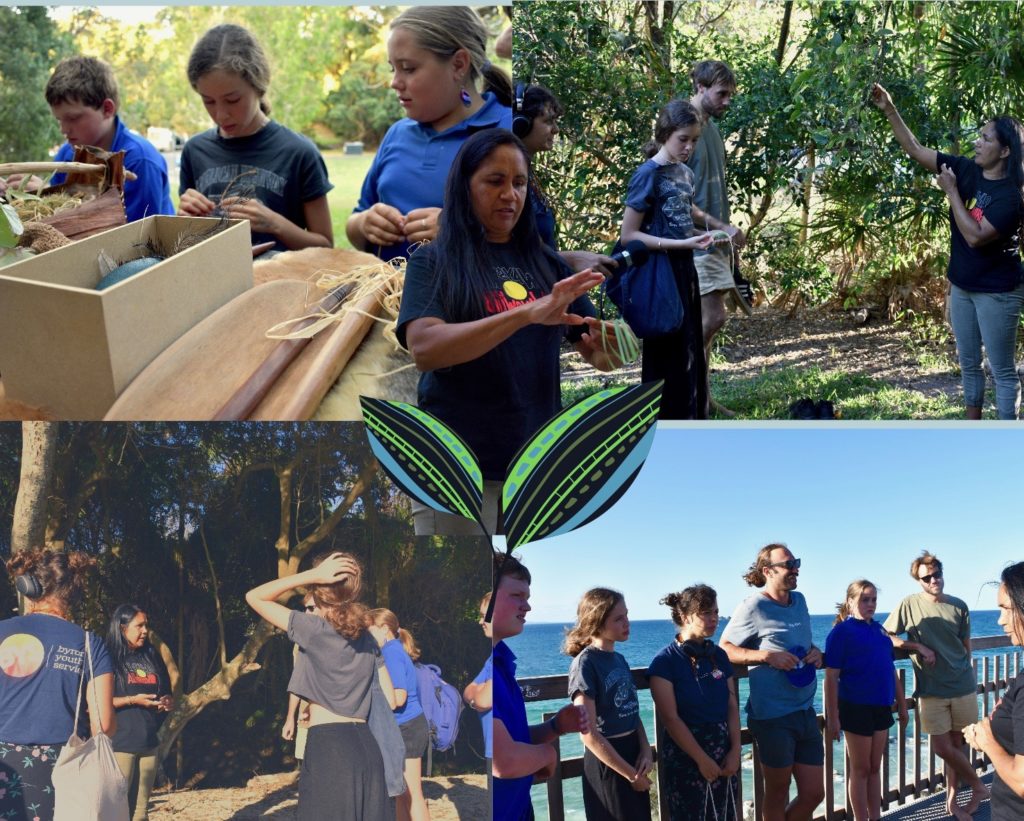
The Byron Youth Service’s Ocean Shores Youth Response Team (OSYRT) project focuses on empowering local youth to engage in community life and play a role in the disaster preparation process. The project offers local youth five weeks of skills-building and awareness workshops, including sessions from a local Indigenous facilitator. Learn more about the project here.
Wee Waa
Wee Waa is situated on the Namoi River floodplain near the confluence of the Namoi River and the Wee Waa Lagoon. The levee surrounding Wee Waa is the only defence against flood inundation and the community is seeking ways to build disaster preparedness and resilience.
Wee Waa is located on the north-western slopes of the New England region in New South Wales, Australia and is known as the “Cotton Capital of Australia”. It is at risk of flooding from the Namoi River, fire (the Pilliga National Park, approximately 50 km away, was impacted as recently as January 2018), and now drought.
FRRR first visited Wee Waa in September 2017 with the DR:FR program in mind and the community showed strong interest and capability in long-term resilience building. Subsequently, FRRR has visited them several times as part of Get Ready NSW DR:FR collaborations and offering support through other programs such as Tackling Tough Times Together.
DR:FR Project
The Wee Waa community has established a Community Cultural Arts Hub where all members of the community can meet and share their artistic and cultural knowledge and skills, and the space also has a gallery where locals can display and sell their works. The hub is designed to be a place where the community meet and support one another and community resilience can be built.
A key activity from the hub is cultural tours, led by the Wee Waa Local Aboriginal Lands Council. The tours will take members of the community and visitors to the Tulladunna Reserve, a culturally significant site containing a Bora Ring and Scarred Trees. The tours will focus on providing traditional knowledge about the country so that community members can better understand how environmental factors can influence how the community is impacted by natural disasters, such as drought and flood.
The facility and project have been well received by the community, and community enthusiasm is constantly growing. The community has come together to deliver the project and are seeing the benefits of increased social networks.
North Richmond / Kurrajong
The North Richmond and Kurrajong communities are located in a valley that, according to the Insurance Council of Australia, has the highest single flood exposure in NSW, if not Australia. Recent growth in populations has raised concerns that new residents are not disaster ready.
North Richmond and Kurrajong are semi-rural communities 67 km north-west of the Sydney central business district, in the City of Hawkesbury local government area. The Hawkesbury River flows through the region and as such, the region is subject to serious flooding, submerging vast areas of farmland, isolating properties and closing the only bridge that results in separating the community from all services which are based on the east bank of the river. Infrastructure NSW has found that if a flood on the scale of the 2011 Brisbane flood occurred in the Nepean-Hawkesbury region, more than 90,000 people would need to be evacuated, more than 12,000 properties would be damaged, and there would be more than $5 billion in damages.
“The Insurance Council of Australia considers this valley to have the highest single flood exposure in NSW, if not Australia.”
Infrastructure NSW – Resilient Valley, Hawkesbury-Nepean Valley Flood Risk Management Strategy, January 2017.
In addition, an anecdotal comment often heard is that a severe fire spreading from the west and reaching Kurrajong would be unstoppable before reaching the river; this is possibly based on the Blue Mountains Fires in October 2013. It is apparent that as more new residents have moved into the area, they have not experienced these hazards and may not be aware of the potential for them to occur, and therefore may not be prepared for these events.
DR:FR Project
As a result of the DR:FR workshops run by FRRR, the North Richmond Working Group was formed with the remit to build grassroots community resilience by determining what is needed to be better prepared for a natural disaster. They identified a key priority for the region was education and community connectedness. On behalf of the Working Group, Peppercorn Services received the first DR:FR grant of $40,000 for the StreetConnect project which seeks to engage school students from the local area to improve community preparedness for natural disasters, support community information sharing in emergencies and improve community safety.
To achieve this outcome, students and teachers will visit 60 percent of local residents at their home to determine their existing knowledge of local emergency services, flood and bushfire risk before showing them how to prepare emergency kits and connecting them to local emergency services if required. The project is designed to be iterative and will likely adapt to include lessons learnt during the project implementation period.
The StreetConnect model has been met with overwhelming support from the community and has even been successful in securing additional funding partners to expand the program into the future. The North Richmond Working Group is excited to see the positive impact it has had during the fire and flooding activity in late 2019; they have also identified additional communities nearby that have also expressed interest in delivering the program in their own communities.
Further Information
If you are interested in learning more:
